
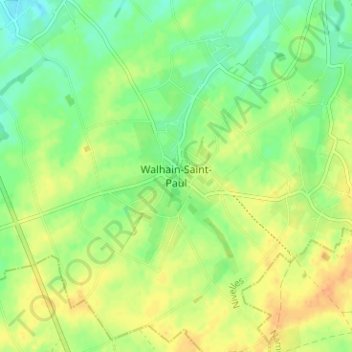
Walhain-Saint-Paul topographic map
Interactive map
Click on the map to display elevation.
About this map
Name: Walhain-Saint-Paul topographic map, elevation, terrain.
Average elevation: 155 m
Minimum elevation: 139 m
Maximum elevation: 171 m
Other topographic maps
Click on a map to view its topography, its elevation and its terrain.
Sart-lez-Walhain
Belgique > Brabant wallon > Nivelles > Walhain-Saint-Paul
Sart-lez-Walhain, Walhain-Saint-Paul, Walhain, Nivelles, Brabant wallon, Wallonie, 1457, Belgique
Average elevation: 157 m