Geolocate

Ansty CP topographic map

Click on the map to display elevation.

About this map

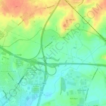
Name: Ansty CP topographic map, elevation, terrain.

Location: Ansty CP, Rugby, Warwickshire, England, United Kingdom (52.42653 -1.44660 52.45518 -1.38950)

Average elevation: 91 m

Minimum elevation: 73 m

Maximum elevation: 118 m

Warwickshire trails, hiking, mountain biking, running and outdoor activities

Other topographic maps

Click on a map to view its topography, its elevation and its terrain.

Draycote Water

United Kingdom > England > Warwickshire > Rugby > Draycote

Average elevation: 92 m

Draycote

United Kingdom > England > Warwickshire > Rugby

Average elevation: 94 m

Newbold on Avon

United Kingdom > England > Warwickshire > Rugby

Average elevation: 98 m

Bilton

United Kingdom > England > Warwickshire > Rugby

Average elevation: 111 m

Newton

United Kingdom > England > Warwickshire > Rugby

Average elevation: 114 m

Bramcote

United Kingdom > England > Warwickshire > Rugby

Average elevation: 105 m

Barnacle

United Kingdom > England > Warwickshire > Rugby > Barnacle

Average elevation: 102 m

Newton

United Kingdom > England > Warwickshire > Rugby

Average elevation: 114 m

Gear up for your next adventure:

🗺️Topographic Maps - Detailed maps showing elevation and terrain features
💧Hydration Reservoirs - Convenient water bladders for hands-free drinking on the move
🧤Thermal Touchscreen Gloves - Stay warm while operating your GPS or smartphone camera
🎒Hiking Daypacks (20L) - Compact backpacks for day trips and technical mountain ascents
🧭Emergency Beacons - Safety beacons for remote outdoor locations

As an Amazon Associate, this site earns from qualifying purchases at no extra cost to you.