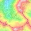
Dobrinishte topographic map
Click on the map to display elevation.
Dobrinishte
Dobrinishte (Bulgarian: Добринище [dobˈriniʃtɛ]) is a small town and ski resort in the Blagoevgrad Province, Bansko Municipality, southwestern Bulgaria. As of 2006 it had 2973 inhabitants. It is located 6 km east of Bansko, a famous winter resort. It has an altitude of 850 m and is surrounded by the Rila, Pirin, and Rhodope mountains. Dobrinishte offers good conditions for both winter and summer tourism: beautiful nature, hospitable population, ski runs, mineral waters and opportunities for rural and ecotourism. According to legends and song, between 6th and 15th century Dobrinishte was a Bulgarian stronghold which halted the Byzantines from invading the country from the valley of the Mesta River.
About this map

Name: Dobrinishte topographic map, elevation, terrain.
Location: Dobrinishte, Bansko, Blagoevgrad, 2777, Bulgaria (41.78108 23.52298 41.86108 23.60298)
Average elevation: 988 m
Minimum elevation: 695 m
Maximum elevation: 1,855 m
Other topographic maps
Click on a map to view its topography, its elevation and its terrain.

Bansko
Bansko lies at the foot of the Pirin Mountains, not far from the national park of the same name, in the valley of the Nestos River at an elevation of 925 meters above sea level. It is a ski resort. The city is about 160 km from Sofia and about 220 km from Thessaloniki.
Average elevation: 1,597 m