
Thank you for supporting this site ❤️
Make a donation
Make a donation
Gear up for your next adventure:
As an Amazon Associate, this site earns from qualifying purchases at no extra cost to you.
Nosara topographic map
Click on the map to display elevation.
Thank you for supporting this site ❤️
Make a donation
Make a donation
Gear up for your next adventure:
As an Amazon Associate, this site earns from qualifying purchases at no extra cost to you.
About this map
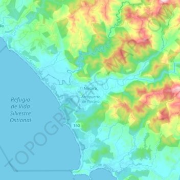
Name: Nosara topographic map, elevation, terrain.
Location: Nosara, Cantón de Nicoya, Guanacaste, 50206, Costa Rica (9.89911 -85.69712 10.05747 -85.56638)
Average elevation: 118 m
Minimum elevation: 0 m
Maximum elevation: 605 m
Thank you for supporting this site ❤️
Make a donation
Make a donation
Gear up for your next adventure:
As an Amazon Associate, this site earns from qualifying purchases at no extra cost to you.