
Terrassa topographic map
Click on the map to display elevation.
Terrassa
The city is located in the Catalan Prelitoral depression (Depressió Prelitoral), at the feet of the Prelitoral mountain range (natural reserve of Sant Llorenç del Munt [ca]) and the average altitude of the city is 277 meters above sea level. It is 20 and 18 kilometres from Barcelona and Montserrat respectively. Terrassa's location as the most-inland city in the Barcelona Metropolitan Region makes it sometimes be referred to as the "entrance to Central Catalonia".
About this map
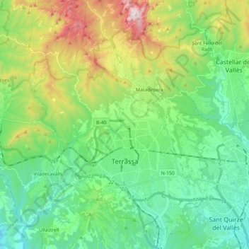
Name: Terrassa topographic map, elevation, terrain.
Location: Terrassa, Vallès Occidental, Barcelona, Catalonia, Spain (41.51630 1.94358 41.64872 2.06882)
Average elevation: 383 m
Minimum elevation: 93 m
Maximum elevation: 1,090 m
Other topographic maps
Click on a map to view its topography, its elevation and its terrain.