Geolocate

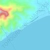
Sampiro topographic map

Click on the map to display elevation.

About this map

Name: Sampiro topographic map, elevation, terrain.

Location: Sampiro, San Juan, Batangas, Calabarzon, Philippines (13.75266 121.35261 13.79726 121.39531)

Average elevation: 46 m

Minimum elevation: 13 m

Maximum elevation: 306 m

Other topographic maps

Click on a map to view its topography, its elevation and its terrain.

Ticalan

Philippines > Batangas > San Juan > Ticalan

Average elevation: 8 m

Hugom

Philippines > Batangas > San Juan > Hugom

Average elevation: 76 m

Malaking Tubig River

Philippines > Batangas > San Juan

Average elevation: 10 m

Gear up for your next adventure:

🧢Thermal Beanie Hats - Prevent heat loss from the head in windy summit conditions
🛰️Handheld GPS Devices - Reliable GPS units for hiking and outdoor navigation
📍Handheld GPS Navigators - Reliable satellite navigation for hiking and off-road exploration
📱Rugged Phone Cases - Heavy-duty protection for smartphones used as secondary GPS tools
👟Heavy Duty Boot Laces - Always carry a spare for your hiking footwear

As an Amazon Associate, this site earns from qualifying purchases at no extra cost to you.