Geolocate

Sway topographic map

Click on the map to display elevation.

About this map

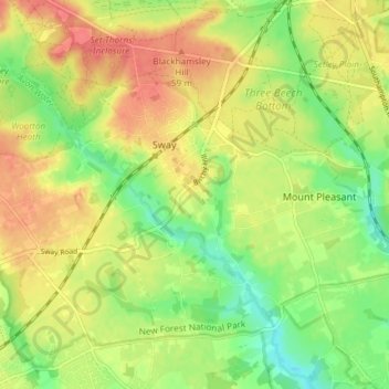
Name: Sway topographic map, elevation, terrain.

Location: Sway, New Forest, Hampshire, England, United Kingdom (50.76260 -1.63715 50.79750 -1.56353)

Average elevation: 36 m

Minimum elevation: 6 m

Maximum elevation: 63 m

Hampshire trails, hiking, mountain biking, running and outdoor activities

Gear up for your next adventure:

📚UK Hiking Guidebooks - Detailed route descriptions for the Lake District, Peaks, and Highlands
👟Heavy Duty Boot Laces - Always carry a spare for your hiking footwear
🧢Thermal Beanie Hats - Prevent heat loss from the head in windy summit conditions
🍱Food Containers - Reusable containers for outdoor meals
🧘Folding Sit Mats - Dry and warm seat for map-reading breaks on damp ground

As an Amazon Associate, this site earns from qualifying purchases at no extra cost to you.