Geolocate

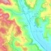
Salviac topographic map

Click on the map to display elevation.

About this map
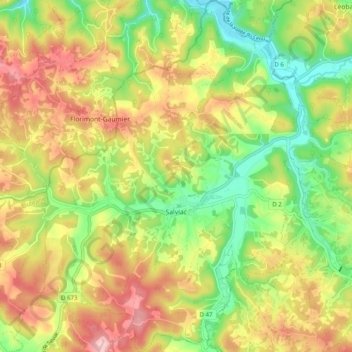
Name: Salviac topographic map, elevation, terrain.

Location: Salviac, Gourdon, Lot, Occitania, Metropolitan France, 46340, France (44.65238 1.22265 44.72298 1.31829)

Average elevation: 220 m

Minimum elevation: 124 m

Maximum elevation: 325 m

Other topographic maps

Click on a map to view its topography, its elevation and its terrain.

Flaujac-Haut

France > Occitania > Lot > Flaujac-Gare

Average elevation: 335 m

Bovila

France > Occitania > Lot > Porte-du-Quercy

Average elevation: 243 m

Labrousse

France > Occitania > Lot > Prayssac

Average elevation: 123 m

Mas Ponchet

France > Occitania > Lot > Cressensac-Sarrazac

Average elevation: 215 m

Les Vignottes

France > Occitania > Lot > Prendeignes

Average elevation: 373 m

Cournou

France > Occitania > Lot > Saint-Vincent-Rive-d'Olt

Average elevation: 243 m

Revers

France > Occitania > Lot > Le Vigan-en-Quercy

Average elevation: 262 m

Brugales

France > Occitania > Lot > Laval-de-Cère

Average elevation: 311 m

Saint-Esprit

France > Occitania > Lot > Martel

Average elevation: 239 m

Concots

France > Occitania > Lot > Concots > Concots

Average elevation: 268 m

Les Boules

France > Occitania > Lot > Bellefont-La Rauze

Average elevation: 276 m

Gear up for your next adventure:

👕Technical Hiking Tees - Moisture-management for high-exertion climbs
🗺️Scratch-off Peak Maps - Track your progress climbing Munros or Wainwrights
🧺Mesh Stuff Sacks - Breathable storage for wet gear or camp organization
📻Hand-Crank Emergency Radios - Stay updated on weather warnings in remote areas
🍲Portable Camping Stoves - Fast-boiling stoves for hot meals on remote topographic survey trips

As an Amazon Associate, this site earns from qualifying purchases at no extra cost to you.