
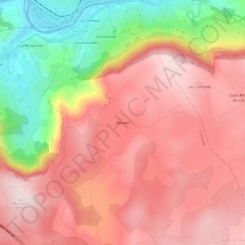
Brunas topographic map
Interactive map
Click on the map to display elevation.
About this map
Name: Brunas topographic map, elevation, terrain.
Average elevation: 632 m
Minimum elevation: 344 m
Maximum elevation: 805 m
Other topographic maps
Click on a map to view its topography, its elevation and its terrain.
Les Cascades
France > Occitanie > Aveyron > Creissels
Les Cascades, Creissels, Millau, Aveyron, Occitanie, France métropolitaine, 12100, France
Average elevation: 511 m