Geolocate

Verdi Close Park topographic map

Click on the map to display elevation.

About this map

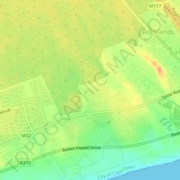
Name: Verdi Close Park topographic map, elevation, terrain.

Location: Verdi Close Park, Cape Town Ward 43, City of Cape Town, Western Cape, South Africa (-34.06727 18.58132 -34.06692 18.58173)

Average elevation: 21 m

Minimum elevation: 0 m

Maximum elevation: 38 m

Other topographic maps

Click on a map to view its topography, its elevation and its terrain.

Europe

South Africa > Western Cape > City of Cape Town

Average elevation: 36 m

Strand

South Africa > Western Cape > City of Cape Town

Average elevation: 22 m

Gear up for your next adventure:

🔋Rechargeable Batteries - Eco-friendly power for headlamps and older GPS units
🎒Replacement Sternum Straps - Repair parts for hiking rucksacks
🧘Folding Sit Mats - Dry and warm seat for map-reading breaks on damp ground
👕Technical Hiking Tees - Moisture-management for high-exertion climbs
Camping Shelters - Emergency and lightweight shelters for outdoor use

As an Amazon Associate, this site earns from qualifying purchases at no extra cost to you.