
Thank you for supporting this site ❤️
Make a donation
Make a donation
Gear up for your next adventure:
As an Amazon Associate, this site earns from qualifying purchases at no extra cost to you.
Sutaripura topographic map
Click on the map to display elevation.
Thank you for supporting this site ❤️
Make a donation
Make a donation
Gear up for your next adventure:
As an Amazon Associate, this site earns from qualifying purchases at no extra cost to you.
About this map
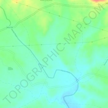
Name: Sutaripura topographic map, elevation, terrain.
Location: Sutaripura, Udaynagar Tahsil, Dewas, Madhya Pradesh, India (22.53057 76.40454 22.55588 76.42103)
Average elevation: 322 m
Minimum elevation: 301 m
Maximum elevation: 366 m
Thank you for supporting this site ❤️
Make a donation
Make a donation
Gear up for your next adventure:
As an Amazon Associate, this site earns from qualifying purchases at no extra cost to you.