
La Garrigue d'en Potis topographic map
Interactive map
Click on the map to display elevation.
About this map
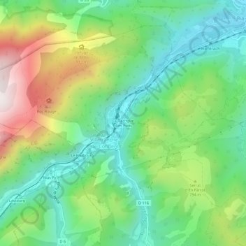
Name: La Garrigue d'en Potis topographic map, elevation, terrain.
Average elevation: 689 m
Minimum elevation: 369 m
Maximum elevation: 1,297 m
Other topographic maps
Click on a map to view its topography, its elevation and its terrain.
Le Faubourg
France > Occitanie > Pyrénées-Orientales > Villefranche-de-Conflent
Le Faubourg, Villefranche-de-Conflent, Prades, Pyrénées-Orientales, Occitanie, France métropolitaine, 66500, France
Average elevation: 738 m