Geolocate

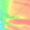
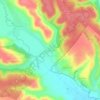
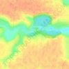
Ostroveni topographic map

Click on the map to display elevation.

About this map

Name: Ostroveni topographic map, elevation, terrain.

Location: Ostroveni, Dolj, Romania (43.74713 23.81024 43.86057 23.96339)

Average elevation: 37 m

Minimum elevation: 24 m

Maximum elevation: 83 m

Other topographic maps

Click on a map to view its topography, its elevation and its terrain.

Băranu

Romania > Dolj

Average elevation: 187 m

Georocel

Romania > Dolj

Average elevation: 91 m

Buzduc

Romania > Dolj

Average elevation: 163 m

Leamna de Jos

Romania > Dolj

Average elevation: 111 m

Ciutura

Romania > Dolj

Average elevation: 135 m

Șumandra

Romania > Dolj

Average elevation: 243 m

Mosna

Romania > Dolj

Average elevation: 214 m

Știubei

Romania > Dolj

Average elevation: 216 m

Picăturile

Romania > Dolj

Average elevation: 203 m

Florești

Romania > Dolj

Average elevation: 149 m

Velesti

Romania > Dolj

Average elevation: 255 m

Veleni

Romania > Dolj

Average elevation: 231 m

Comănicea

Romania > Dolj

Average elevation: 227 m

Motoci

Romania > Dolj

Average elevation: 206 m

Cornetu

Romania > Dolj

Average elevation: 147 m

Beloț

Romania > Dolj

Average elevation: 151 m

Balota de Sus

Romania > Dolj

Average elevation: 228 m

Înfrățirea

Romania > Dolj

Average elevation: 259 m

Golfin

Romania > Dolj

Average elevation: 164 m

Gear up for your next adventure:

⌚Altimeter Watches - Watches measuring altitude for mountain activities
🔋Solar Power Banks - Keep your GPS and phone charged during multi-day expeditions
🔋Solar Chargers - Eco-friendly charging solutions for outdoor use
🧢Thermal Beanie Hats - Prevent heat loss from the head in windy summit conditions
🦟Anti-Midge & Tick Repellent - Vital for hiking in the Scottish Highlands during summer

As an Amazon Associate, this site earns from qualifying purchases at no extra cost to you.