
Thank you for supporting this site ❤️
Make a donation
Make a donation
Gear up for your next adventure:
As an Amazon Associate, this site earns from qualifying purchases at no extra cost to you.
Binntal topographic map
Click on the map to display elevation.
Thank you for supporting this site ❤️
Make a donation
Make a donation
Gear up for your next adventure:
As an Amazon Associate, this site earns from qualifying purchases at no extra cost to you.
About this map
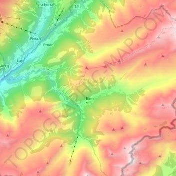
Name: Binntal topographic map, elevation, terrain.
Location: Binntal, Grengiols, Östlich Raron, Wallis, 3993, Switzerland (46.36019 8.10565 46.38263 8.26840)
Average elevation: 2,019 m
Minimum elevation: 892 m
Maximum elevation: 3,173 m
Thank you for supporting this site ❤️
Make a donation
Make a donation
Gear up for your next adventure:
As an Amazon Associate, this site earns from qualifying purchases at no extra cost to you.