
Bukit Temoyong topographic map
Interactive map
Click on the map to display elevation.
About this map
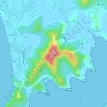
Name: Bukit Temoyong topographic map, elevation, terrain.
Location: Bukit Temoyong, Pantai Tengah, Langkawi, Kedah, Malaysia (6.27671 99.74140 6.27681 99.74150)
Average elevation: 19 m
Minimum elevation: -1 m
Maximum elevation: 155 m
Other topographic maps
Click on a map to view its topography, its elevation and its terrain.
Pantai Tengah
Malaysia > Kedah > Pantai Tengah
Pantai Tengah, Langkawi, Kedah, Malaysia
Average elevation: 12 m