
Á dos Ruivos topographic map
Interactive map
Click on the map to display elevation.
About this map
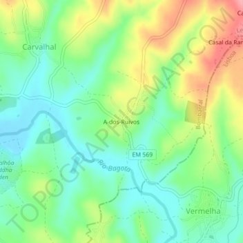
Name: Á dos Ruivos topographic map, elevation, terrain.
Location: Á dos Ruivos, Carvalhal, Bombarral, Leiria, 2550-538, Portugal (39.27018 -9.12802 39.29018 -9.10802)
Average elevation: 74 m
Minimum elevation: 33 m
Maximum elevation: 145 m