
Make a donation
Gear up for your next adventure:
As an Amazon Associate, this site earns from qualifying purchases at no extra cost to you.
Ridgeley topographic map
Click on the map to display elevation.
Make a donation
Gear up for your next adventure:
As an Amazon Associate, this site earns from qualifying purchases at no extra cost to you.
About this map
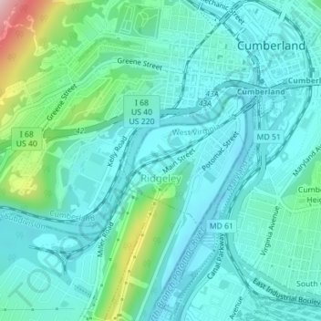
Name: Ridgeley topographic map, elevation, terrain.
Location: Ridgeley, Mineral County, West Virginia, United States (39.63741 -78.77829 39.64843 -78.76510)
Average elevation: 220 m
Minimum elevation: 174 m
Maximum elevation: 412 m
Make a donation
Gear up for your next adventure:
As an Amazon Associate, this site earns from qualifying purchases at no extra cost to you.
Other topographic maps
Click on a map to view its topography, its elevation and its terrain.
Make a donation
Gear up for your next adventure:
As an Amazon Associate, this site earns from qualifying purchases at no extra cost to you.
West Virginia Central Junction
United States > West Virginia > Mineral County > Beryl
Average elevation: 432 m