
Sagara topographic map
Click on the map to display elevation.
About this map
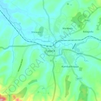
Name: Sagara topographic map, elevation, terrain.
Location: Sagara, Sagara taluk, Shimoga, Karnataka, 577400, India (14.12650 74.98639 14.20650 75.06639)
Average elevation: 598 m
Minimum elevation: 564 m
Maximum elevation: 734 m