
Chancery Lane topographic map
Interactive map
Click on the map to display elevation.
About this map
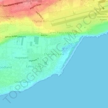
Name: Chancery Lane topographic map, elevation, terrain.
Location: Chancery Lane, Christ Church, BB17121, Barbados (13.04031 -59.52615 13.08031 -59.48615)
Average elevation: 23 m
Minimum elevation: -1 m
Maximum elevation: 89 m
Other topographic maps
Click on a map to view its topography, its elevation and its terrain.