
Pernampattu topographic map
Interactive map
Click on the map to display elevation.
About this map
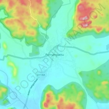
Name: Pernampattu topographic map, elevation, terrain.
Location: Pernampattu, Gudiyatham, Vellore, Tamil Nadu, 635810, India (12.89667 78.67875 12.97667 78.75875)
Average elevation: 425 m
Minimum elevation: 339 m
Maximum elevation: 694 m