
Mount Snowdon topographic map
Interactive map
Click on the map to display elevation.
About this map
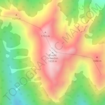
Name: Mount Snowdon topographic map, elevation, terrain.
Location: Mount Snowdon, Tasman, New Zealand (-41.03486 172.60295 -41.03476 172.60305)
Average elevation: 1,410 m
Minimum elevation: 938 m
Maximum elevation: 1,848 m
Other topographic maps
Click on a map to view its topography, its elevation and its terrain.