
Karangmoncol topographic map
Interactive map
Click on the map to display elevation.
About this map
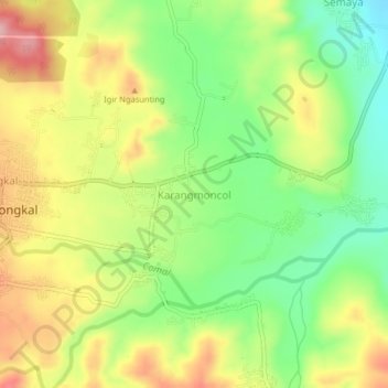
Name: Karangmoncol topographic map, elevation, terrain.
Location: Karangmoncol, Pemalang, Central Java, Java, Indonesia (-7.12138 109.32574 -7.08138 109.36574)
Average elevation: 170 m
Minimum elevation: 91 m
Maximum elevation: 260 m