
Bonnevoie topographic map
Interactive map
Click on the map to display elevation.
About this map
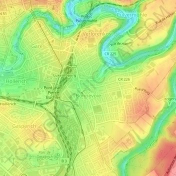
Name: Bonnevoie topographic map, elevation, terrain.
Location: Bonnevoie, Luxembourg, Canton Luxembourg, Luxembourg (49.58614 6.13203 49.60835 6.16767)
Average elevation: 290 m
Minimum elevation: 246 m
Maximum elevation: 328 m
Other topographic maps
Click on a map to view its topography, its elevation and its terrain.
Luxembourg City: Old Quarters & Fortifications
Luxembourg > Canton Luxembourg > Luxembourg
Average elevation: 294 m