Geolocate

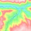
Seneca topographic map

Click on the map to display elevation.

About this map

Name: Seneca topographic map, elevation, terrain.

Location: Seneca, Grant County, Oregon, 97873, United States (44.12667 -118.98664 44.14113 -118.96612)

Average elevation: 1,453 m

Minimum elevation: 1,417 m

Maximum elevation: 1,609 m

Other topographic maps

Click on a map to view its topography, its elevation and its terrain.

Kimberly

United States > Oregon > Grant County

Average elevation: 711 m

Dale

United States > Oregon > Grant County

Average elevation: 1,035 m

Gear up for your next adventure:

🍲Portable Camping Stoves - Fast-boiling stoves for hot meals on remote topographic survey trips
🧢Thermal Beanie Hats - Prevent heat loss from the head in windy summit conditions
🎒Multi-day Trekking Packs - Large capacity backpacks for wild camping and long-distance trails
🧺Microfibre Travel Towels - Fast-drying and compact towels for wild swimming and camping
🔋Lithium AA Batteries - Long-lasting power that performs well in cold mountain weather

As an Amazon Associate, this site earns from qualifying purchases at no extra cost to you.