
La Grande Dixence topographic map
Interactive map
Click on the map to display elevation.
About this map
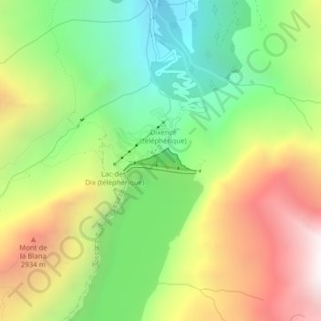
Name: La Grande Dixence topographic map, elevation, terrain.
Average elevation: 2,433 m
Minimum elevation: 1,767 m
Maximum elevation: 3,309 m
Other topographic maps
Click on a map to view its topography, its elevation and its terrain.
La Luette
Zwitserland > Valais/Wallis > Hérémence
La Luette, Hérémence, Hérens, Valais/Wallis, 1987, Zwitserland
Average elevation: 3,132 m