
Independencia topographic map
Interactive map
Click on the map to display elevation.
About this map
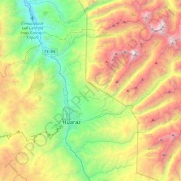
Name: Independencia topographic map, elevation, terrain.
Location: Independencia, Huaraz, Ancash, Peru (-9.58246 -77.63426 -9.36797 -77.31448)
Average elevation: 4,096 m
Minimum elevation: 2,704 m
Maximum elevation: 6,195 m
Other topographic maps
Click on a map to view its topography, its elevation and its terrain.
Laguna Llaca
Peru > Ancash > Independencia
Laguna Llaca, Independencia, Huaraz, Ancash, Peru
Average elevation: 4,825 m