Geolocate

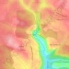
Montbartier topographic map

Click on the map to display elevation.

About this map

Name: Montbartier topographic map, elevation, terrain.

Location: Montbartier, Montauban, Tarn-et-Garonne, Occitania, Metropolitan France, 82700, France (43.89729 1.25109 43.93512 1.32207)

Average elevation: 115 m

Minimum elevation: 95 m

Maximum elevation: 146 m

Other topographic maps

Click on a map to view its topography, its elevation and its terrain.
La Nauze

France > Occitania > Tarn-et-Garonne > Molières > Molières

Average elevation: 140 m

Lac Doux

France > Occitania > Tarn-et-Garonne > Loze > Mas d'Estèbe

Average elevation: 329 m

Badio

France > Occitania > Tarn-et-Garonne > Castelferrus

Average elevation: 101 m

Gear up for your next adventure:

👕Merino Base Layers - Natural temperature regulation for cold weather hiking and camping
🧺Ultralight Dry Bags - Organize and waterproof your gear inside your rucksack
🔋Solar Chargers - Eco-friendly charging solutions for outdoor use
🕶️Polarized Sunglasses - Reduces glare from snow and water when reading terrain
📍Handheld GPS Navigators - Reliable satellite navigation for hiking and off-road exploration

As an Amazon Associate, this site earns from qualifying purchases at no extra cost to you.