Geolocate

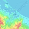
Mount Maunganui topographic map

Click on the map to display elevation.

About this map

Name: Mount Maunganui topographic map, elevation, terrain.

Location: Mount Maunganui, Tauranga City, Bay of Plenty, New Zealand (-37.68315 176.16264 -37.62128 176.22848)

Average elevation: 5 m

Minimum elevation: 0 m

Maximum elevation: 224 m

Other topographic maps

Click on a map to view its topography, its elevation and its terrain.
Tauranga

New Zealand > Bay of Plenty > Tauranga City

Average elevation: 66 m

Mangatawa

New Zealand > Bay of Plenty > Tauranga City > Papamoa

Average elevation: 18 m

Tauranga

New Zealand > Bay of Plenty > Tauranga City

Average elevation: 63 m

Greerton

New Zealand > Bay of Plenty > Tauranga City

Average elevation: 31 m

Tauranga

New Zealand > Bay of Plenty > Tauranga City

Average elevation: 66 m

Tauranga

New Zealand > Bay of Plenty > Tauranga City

Average elevation: 66 m

Tauranga

New Zealand > Bay of Plenty > Tauranga City

Average elevation: 66 m

Tauranga

New Zealand > Bay of Plenty > Tauranga City

Average elevation: 66 m

Gear up for your next adventure:

👕Merino Base Layers - Natural temperature regulation for cold weather hiking and camping
🕶️Glacier Goggles - Maximum protection for high-altitude snow topography
👟Heavy Duty Boot Laces - Always carry a spare for your hiking footwear
📻Hand-Crank Emergency Radios - Stay updated on weather warnings in remote areas
🎒Hiking Child Carriers - Explore the outdoors with the whole family safely

As an Amazon Associate, this site earns from qualifying purchases at no extra cost to you.