
Thank you for supporting this site ❤️
Make a donation
Make a donation
Gear up for your next adventure:
As an Amazon Associate, this site earns from qualifying purchases at no extra cost to you.
Pellerina topographic map
Click on the map to display elevation.
Thank you for supporting this site ❤️
Make a donation
Make a donation
Gear up for your next adventure:
As an Amazon Associate, this site earns from qualifying purchases at no extra cost to you.
About this map
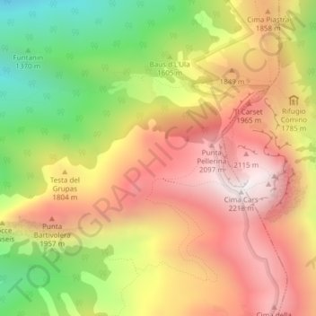
Name: Pellerina topographic map, elevation, terrain.
Location: Pellerina, Chiusa di Pesio, Cuneo, Piedmont, Italy (44.21249 7.68380 44.23249 7.70380)
Average elevation: 1,693 m
Minimum elevation: 1,088 m
Maximum elevation: 2,195 m
Thank you for supporting this site ❤️
Make a donation
Make a donation
Gear up for your next adventure:
As an Amazon Associate, this site earns from qualifying purchases at no extra cost to you.