
Hadamar topographic map
Interactive map
Click on the map to display elevation.
Hadamar
Hadamar lies 7 km north of Limburg between Cologne and Frankfurt am Main on the southern edge of the Westerwald at elevations from 120 to 390 m above sea level.
About this map
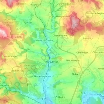
Name: Hadamar topographic map, elevation, terrain.
Location: Hadamar, Landkreis Limburg-Weilburg, Hesse, 65589, Germany (50.42390 7.99434 50.49321 8.15132)
Average elevation: 215 m
Minimum elevation: 110 m
Maximum elevation: 396 m
Other topographic maps
Click on a map to view its topography, its elevation and its terrain.