
Sinemorets topographic map
Interactive map
Click on the map to display elevation.
About this map
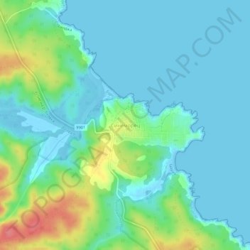
Name: Sinemorets topographic map, elevation, terrain.
Location: Sinemorets, Tsarevo, Burgas, 8279, Bulgaria (42.04105 27.95615 42.08105 27.99615)
Average elevation: 18 m
Minimum elevation: -3 m
Maximum elevation: 76 m
Other topographic maps
Click on a map to view its topography, its elevation and its terrain.