Geolocate

Netstal topographic map

Click on the map to display elevation.

About this map
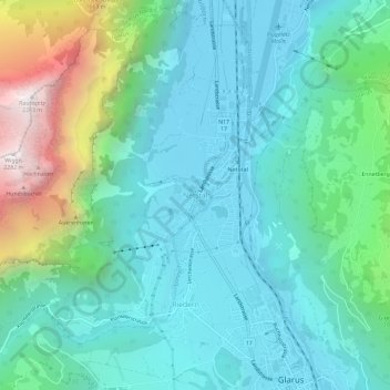
Name: Netstal topographic map, elevation, terrain.

Location: Netstal, Glarus, 8754, Switzerland (47.04113 9.03297 47.08113 9.07297)

Average elevation: 850 m

Minimum elevation: 443 m

Maximum elevation: 2,269 m

Gear up for your next adventure:

📸Action Camera Chest Mounts - Record your ascent following topographic paths hands-free
📢Survival Whistles - Essential safety gear for signaling for help in mountain fog
🔦Outdoor Torches - Reliable torches for night navigation
🧭Emergency Beacons - Safety beacons for remote outdoor locations
🧥Softshell Jackets - Breathable jackets for active outdoor use

As an Amazon Associate, this site earns from qualifying purchases at no extra cost to you.