
Bwizibwera topographic map
Interactive map
Click on the map to display elevation.
About this map
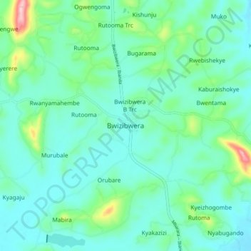
Name: Bwizibwera topographic map, elevation, terrain.
Location: Bwizibwera, Mbarara, Western Region, Uganda (-0.48054 30.53261 -0.40054 30.61261)
Average elevation: 1,462 m
Minimum elevation: 1,416 m
Maximum elevation: 1,656 m