
白帝镇 topographic map
Interactive map
Click on the map to display elevation.
About this map
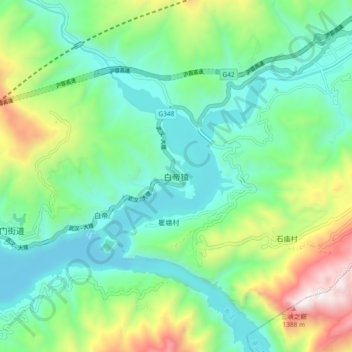
Name: 白帝镇 topographic map, elevation, terrain.
Location: 白帝镇, 奉节县, 渝东北三峡库区城镇群, 重庆市, 中国 (31.01912 109.54875 31.09912 109.62875)
Average elevation: 436 m
Minimum elevation: 72 m
Maximum elevation: 1,363 m
Other topographic maps
Click on a map to view its topography, its elevation and its terrain.