
La Drayère topographic map
Interactive map
Click on the map to display elevation.
About this map
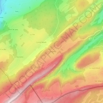
Name: La Drayère topographic map, elevation, terrain.
Average elevation: 1,014 m
Minimum elevation: 773 m
Maximum elevation: 1,202 m
Other topographic maps
Click on a map to view its topography, its elevation and its terrain.
Les Picardes
France > Bourgogne-Franche-Comté > Doubs > Ville-du-Pont
Les Picardes, Ville-du-Pont, Pontarlier, Doubs, Bourgogne-Franche-Comté, France métropolitaine, 25650, France
Average elevation: 902 m