
Ysbyty Ystwyth topographic map
Interactive map
Click on the map to display elevation.
About this map
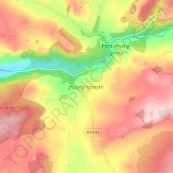
Name: Ysbyty Ystwyth topographic map, elevation, terrain.
Location: Ysbyty Ystwyth, Ceredigion, Wales, SY25 6DE, United Kingdom (52.30751 -3.88166 52.34751 -3.84166)
Average elevation: 259 m
Minimum elevation: 83 m
Maximum elevation: 388 m
Ceredigion trails, hiking, mountain biking, running and outdoor activities
Other topographic maps
Click on a map to view its topography, its elevation and its terrain.