
Mellenbach topographic map
Interactive map
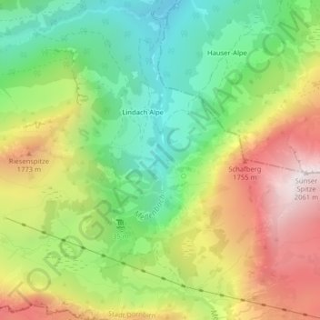
Click on the map to display elevation.
About this map
Name: Mellenbach topographic map, elevation, terrain.
Average elevation: 1,449 m
Minimum elevation: 1,010 m
Maximum elevation: 2,035 m
Other topographic maps
Click on a map to view its topography, its elevation and its terrain.
Staufensee
Österreich > Vorarlberg > Stadt Dornbirn
Staufensee, Stadt Dornbirn, Bezirk Dornbirn, Vorarlberg, 6850, Österreich
Average elevation: 790 m
Karren
Österreich > Vorarlberg > Stadt Dornbirn
Karren, Stadt Dornbirn, Bezirk Dornbirn, Vorarlberg, 6850, Österreich
Average elevation: 730 m
Hoher Freschen
Österreich > Vorarlberg > Stadt Dornbirn
Hoher Freschen, Stadt Dornbirn, Bezirk Dornbirn, Vorarlberg, Österreich
Average elevation: 1,572 m