
Gartrop topographic map
Interactive map
Click on the map to display elevation.
About this map
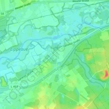
Name: Gartrop topographic map, elevation, terrain.
Location: Gartrop, Hünxe, Kreis Wesel, Nordrhein-Westfalen, Deutschland (51.64102 6.79027 51.68102 6.83027)
Average elevation: 34 m
Minimum elevation: 22 m
Maximum elevation: 71 m