
Belmontet topographic map
Interactive map
Click on the map to display elevation.
About this map
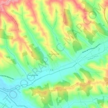
Name: Belmontet topographic map, elevation, terrain.
Average elevation: 154 m
Minimum elevation: 106 m
Maximum elevation: 221 m
Other topographic maps
Click on a map to view its topography, its elevation and its terrain.
Saint-Caprais
France > Occitanie > Tarn-et-Garonne > Belmontet
Saint-Caprais, Belmontet, La Salvetat-Belmontet, Montauban, Tarn-et-Garonne, Occitanie, France métropolitaine, 46800, France
Average elevation: 145 m