
Patchway topographic map
Click on the map to display elevation.
About this map
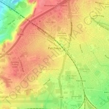
Name: Patchway topographic map, elevation, terrain.
Average elevation: 68 m
Minimum elevation: 10 m
Maximum elevation: 93 m
South Gloucestershire trails, hiking, mountain biking, running and outdoor activities
Other topographic maps
Click on a map to view its topography, its elevation and its terrain.
The Slad
United Kingdom > England > South Gloucestershire > Thornbury > Milbury Heath
Average elevation: 75 m
Goosegreen
United Kingdom > England > South Gloucestershire > Frampton Cotterell
Average elevation: 60 m
Woodmancote
United Kingdom > England > South Gloucestershire > Stroud > Dursley
Average elevation: 130 m
Marsh Common
United Kingdom > England > South Gloucestershire > Easter Compton
Average elevation: 10 m
Little Sodbury End
United Kingdom > England > South Gloucestershire > Horton > Little Sodbury End
Average elevation: 114 m
Branson Court
United Kingdom > England > South Gloucestershire > Bradley Stoke
Average elevation: 62 m