
Isle Royale topographic map
Interactive map
Click on the map to display elevation.
About this map
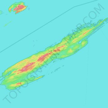
Name: Isle Royale topographic map, elevation, terrain.
Location: Isle Royale, Keweenaw County, Michigan, United States (47.82376 -89.23555 48.19102 -88.42232)
Average elevation: 190 m
Minimum elevation: 176 m
Maximum elevation: 443 m