
Holalkere topographic map
Interactive map
Click on the map to display elevation.
Holalkere
Holalkere is located at 14°02′N 76°11′E / 14.03°N 76.18°E / 14.03; 76.18. It has an average elevation of 711 metres (2332 feet).
About this map
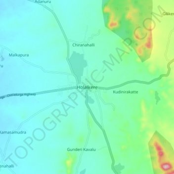
Name: Holalkere topographic map, elevation, terrain.
Average elevation: 715 m
Minimum elevation: 662 m
Maximum elevation: 948 m