
Wodanga ward topographic map
Interactive map
Click on the map to display elevation.
About this map
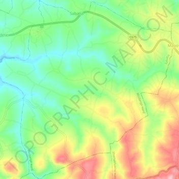
Name: Wodanga ward topographic map, elevation, terrain.
Location: Wodanga ward, Sabatia, Vihiga County, Western, Kenya (0.07607 34.76899 0.12679 34.81963)
Average elevation: 1,643 m
Minimum elevation: 1,571 m
Maximum elevation: 1,746 m