
Thank you for supporting this site ❤️
Make a donation
Make a donation
Gear up for your next adventure:
As an Amazon Associate, this site earns from qualifying purchases at no extra cost to you.
Buğralar topographic map
Click on the map to display elevation.
Thank you for supporting this site ❤️
Make a donation
Make a donation
Gear up for your next adventure:
As an Amazon Associate, this site earns from qualifying purchases at no extra cost to you.
About this map
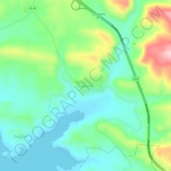
Name: Buğralar topographic map, elevation, terrain.
Location: Buğralar, Çamlıdere, Ankara, Central Anatolia Region, Turkey (40.39589 32.39884 40.43589 32.43884)
Average elevation: 1,036 m
Minimum elevation: 955 m
Maximum elevation: 1,232 m
Thank you for supporting this site ❤️
Make a donation
Make a donation
Gear up for your next adventure:
As an Amazon Associate, this site earns from qualifying purchases at no extra cost to you.