
بنور topographic map
Interactive map
Click on the map to display elevation.
About this map
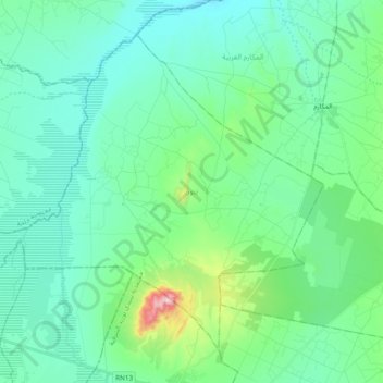
Name: بنور topographic map, elevation, terrain.
Location: بنور, معتمدية سيدي بوزيد الشرقية, Sidi Bouzid, Tunisia (35.11683 9.41705 35.24520 9.60811)
Average elevation: 344 m
Minimum elevation: 280 m
Maximum elevation: 635 m
Other topographic maps
Click on a map to view its topography, its elevation and its terrain.