
Make a donation
Gear up for your next adventure:
As an Amazon Associate, this site earns from qualifying purchases at no extra cost to you.
Orovada topographic map
Click on the map to display elevation.
Make a donation
Gear up for your next adventure:
As an Amazon Associate, this site earns from qualifying purchases at no extra cost to you.
About this map
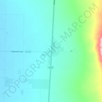
Name: Orovada topographic map, elevation, terrain.
Location: Orovada, Humboldt County, Nevada, 89425, United States (41.54970 -117.80535 41.58970 -117.76535)
Average elevation: 1,352 m
Minimum elevation: 1,294 m
Maximum elevation: 1,603 m
Make a donation
Gear up for your next adventure:
As an Amazon Associate, this site earns from qualifying purchases at no extra cost to you.
Other topographic maps
Click on a map to view its topography, its elevation and its terrain.
North Jackson Mountains Wilderness
United States > Nevada > Humboldt County
Average elevation: 1,747 m
Make a donation
Gear up for your next adventure:
As an Amazon Associate, this site earns from qualifying purchases at no extra cost to you.
Make a donation
Gear up for your next adventure:
As an Amazon Associate, this site earns from qualifying purchases at no extra cost to you.