
Thank you for supporting this site ❤️
Make a donation
Make a donation
Gear up for your next adventure:
As an Amazon Associate, this site earns from qualifying purchases at no extra cost to you.
Clots topographic map
Click on the map to display elevation.
Thank you for supporting this site ❤️
Make a donation
Make a donation
Gear up for your next adventure:
As an Amazon Associate, this site earns from qualifying purchases at no extra cost to you.
About this map
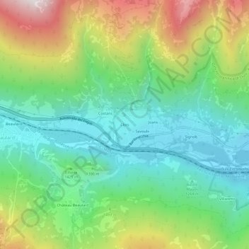
Name: Clots topographic map, elevation, terrain.
Location: Clots, Oulx, Torino, Piedmont, 10056, Italy (45.02568 6.76504 45.06568 6.80504)
Average elevation: 1,445 m
Minimum elevation: 1,078 m
Maximum elevation: 2,166 m
Thank you for supporting this site ❤️
Make a donation
Make a donation
Gear up for your next adventure:
As an Amazon Associate, this site earns from qualifying purchases at no extra cost to you.