
San José de Playón topographic map
Interactive map
Click on the map to display elevation.
About this map
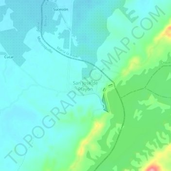
Name: San José de Playón topographic map, elevation, terrain.
Average elevation: 40 m
Minimum elevation: 18 m
Maximum elevation: 126 m
Other topographic maps
Click on a map to view its topography, its elevation and its terrain.
Libertad
Colombia > Sucre > San Onofre
Libertad, San Onofre, Morrosquillo, Sucre, RAP Caribe, Colombia
Average elevation: 33 m