
Rushock topographic map
Interactive map
Click on the map to display elevation.
About this map
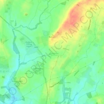
Name: Rushock topographic map, elevation, terrain.
Average elevation: 61 m
Minimum elevation: 41 m
Maximum elevation: 90 m
Other topographic maps
Click on a map to view its topography, its elevation and its terrain.
Bewdley
United Kingdom > England > Wyre Forest > Bewdley
Bewdley, Worcestershire, West Midlands, England, DY12 2AP, United Kingdom
Average elevation: 83 m
Dowles Brook
United Kingdom > England > Wyre Forest > Bewdley
Dowles Brook, Bewdley, Wyre Forest, Worcestershire, West Midlands, England, DY12 3AA, United Kingdom
Average elevation: 72 m
Wolverley and Cookley
United Kingdom > England > Wyre Forest
Wolverley and Cookley, Wyre Forest, Worcestershire, West Midlands, England, United Kingdom
Average elevation: 82 m