
Mookgophong Ward 1 topographic map
Interactive map
Click on the map to display elevation.
About this map
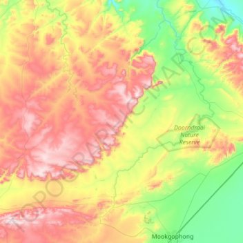
Name: Mookgophong Ward 1 topographic map, elevation, terrain.
Average elevation: 1,336 m
Minimum elevation: 1,001 m
Maximum elevation: 1,806 m
Other topographic maps
Click on a map to view its topography, its elevation and its terrain.
Doorndraai Dam
RSA > Limpopo > Mookgopong Local Municipality
Doorndraai Dam, Mookgophong Ward 1, Mookgopong Local Municipality, Limpopo, RSA
Average elevation: 1,258 m